McMinnville and the surrounding Warren County area are preparing for a potentially significant bout of winter weather this weekend, as multiple forecasting sources are closely monitoring a developing winter storm expected to impact the region from late Friday through Sunday, Jan. 23-25.
Across the board, forecasts agree that conditions will begin deteriorating Friday night as colder air moves in and precipitation transitions to snow. Daytime conditions Friday are expected to remain cloudy and chilly, with highs near 39 to 41 degrees and north winds between 10 and 15 mph. While daytime precipitation chances remain low, attention quickly turns as the sun goes down.
Both The Weather Channel and Weather Underground project snow developing late Friday evening and becoming steadier overnight, with lows near 20 degrees. Those outlets estimate an initial accumulation of 3 to 5 inches by Saturday morning. Fox Weather and the National Weather Service also indicate snow showers Friday night, with temperatures dipping into the low 20s.
Saturday appears to be the most impactful day of the storm. Several sources warn of heavy snow at times, with The Weather Channel and Weather Underground projecting total snowfall of 8 to 12 inches during the day alone. High temperatures are expected to struggle into the upper 20s, keeping snow from melting and allowing accumulations to build quickly. AccuWeather adds that a wintry mix of snow, sleet and freezing rain could occur at times, particularly Friday night and again Saturday night, creating slick and dangerous travel conditions.
Saturday night remains active, with continued snow likely and temperatures hovering in the low 20s or even upper teens. Additional accumulations of 5 to 8 inches are possible according to some forecasts, while the National Weather Service maintains a high probability of snow showers continuing overnight.
Snow chances gradually taper Sunday, though lingering impacts are expected. Forecasts generally call for light snow or snow showers during the morning, with highs near 29 to 31 degrees. Accumulations of 1 to 3 inches are possible before precipitation diminishes later in the day. Sunday night will be bitterly cold, with lows forecast to drop into the mid to upper teens, and as low as 10 degrees in some areas.
While exact totals vary by source, forecasters agree that McMinnville could see substantial snowfall over the three-day period, with the potential for icy conditions making travel hazardous.
Residents are urged to take precautions, especially if travel becomes necessary. Safety officials emphasize that staying home during winter storms is the safest option whenever possible. Residents are advised to leave water dripping in their homes to help prevent frozen pipes.
For those who must be on the roads, drivers should check weather and road conditions before leaving, reduce speeds, avoid using cruise control and leave extra space between vehicles. Clearing all snow and ice from windows, mirrors, lights and roofs is critical for visibility and safety.
Vehicle preparedness is also key. Keeping fuel tanks at least half full, carrying emergency supplies such as blankets, food, water, flashlights and warm clothing, and ensuring tires and wipers are in good condition can make a significant difference if conditions worsen.
Finally, travelers are encouraged to let someone know their plans and, if stranded, to stay with their vehicle until help arrives.
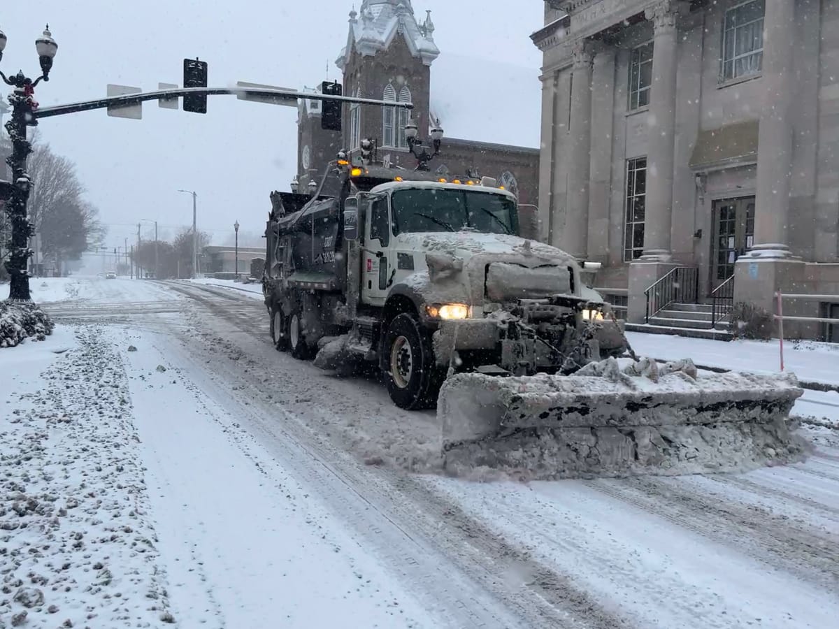
City and county road crews were busy Tuesday morning taking the necessary steps to try and battle back icy road conditions.
County Highway Superintendent Levie Glenn told the Main Street Journal Tuesday his department had 190 tons of salt in stock, and he had ordered 90 more which should be delivered by Friday. Five salt trucks are loaded and equipped with plows, and different plans are in place based on the type of snowfall and potential for icy conditions that may arise.
"We may have to work some long hours, but we'll work as long as we can," Glenn said. "You keep plowing, and sometimes you think you're not doing any good; but the quicker you can get it off the roads, the less chance there is of ice building up."
Glenn said crews are already on standby to work long hours this weekend, and advised residents to stay home if possible during bad conditions. If they have to venture out, he cautioned motorists to be aware of highway department vehicles sharing the roadways.
McMinnville Public Works Director Lyndon Bussell said the city had ordered 45 additional tons of salt. Delivery is expected this week to add to the department’s existing supply.
“Our goal is to be out salting immediately Friday,” Bussell said. “We’re not going to wait for it to cover the road; as soon as we see it sticking, we’re going to be slinging some salt.”
Additionally, normal services to local residents could be delayed or postponed if the forecast remains unchanged - including sanitation services. Josh Roberts, Solid Waste Director for Warren County, said his department recommends residents using the local convenience centers do so Friday ahead of any impending icy conditions.
“We possibly could have to close due to inclement weather,” Roberts explained. “And there’s going to be a lot of unknown going into Monday and the rest of next week.”
With winter weather poised to make its presence felt, local officials and forecasters encourage residents to stay informed, use caution and prioritize safety throughout the weekend.
(Editor's note: This story will be updated as needed as the weekend draws closer.)
Share this article
The link has been copied!
Members Discussion
Your link has expired. Please request a new one.
Your link has expired. Please request a new one.
Your link has expired. Please request a new one.
Great! You've successfully signed up.
Great! You've successfully signed up.
Welcome back! You've successfully signed in.
Success! You now have access to additional content.